0 引言
1 区域地质概况
2 造山运动对南江地区的控制
2.1 大巴山对南江地区控制
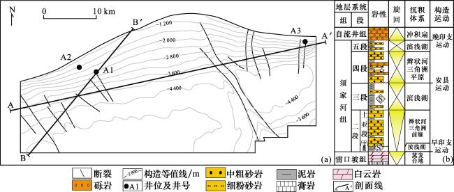
图2 川东北南江地区须四段顶面构造平面图(a)与地层综合柱状图(b)Fig.2 Distribution diagram(a) of top structure in the fourth member of the Xujiahe Formation in Nanjiang area and stratigraphic column(b) in the Nanjiang area, Northeast Sichuan Basin |
2.2 米仓山对南江地区控制
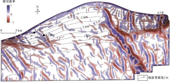
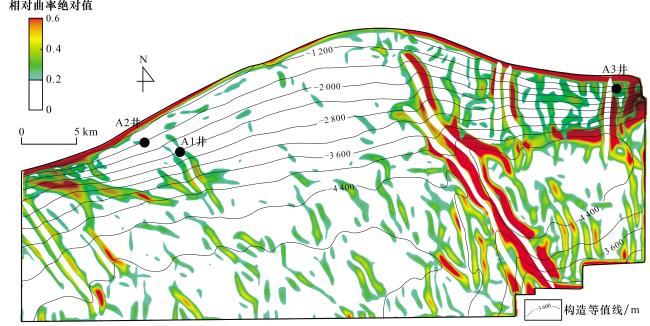
2.3 曲率的地质含义
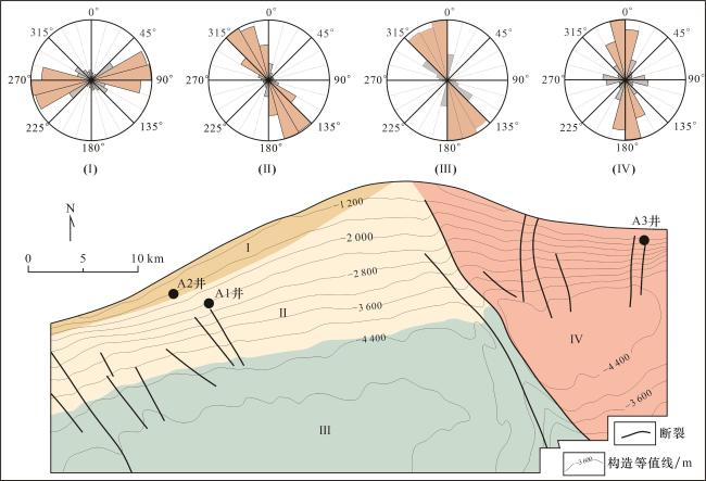
2.4 构造区域划分
3 裂缝识别
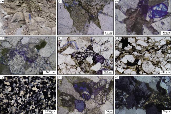
3.1 须四段地质现象观测
图7 川东北地区桥亭剖面须家河组野外露头及岩石显微薄片照片(a)桥亭剖面,须四段,灰色厚层中砂岩,裂缝发育;(b)桥亭剖面,须四段,裂缝及溶蚀作用,单偏光;(c)桥亭剖面,须四段,裂缝及长石溶蚀孔,单偏光;(d)桥亭剖面,须四段,长石破裂缝,单偏光;(e)桥亭剖面,须四段,长石压弯变形,单偏光;(f)桥亭剖面,须四段,云母压弯变形,单偏光;(g)桥亭剖面,须四段,硅质胶结裂缝,正交光;(h)桥亭剖面,须四段,溶蚀残余,单偏光;(i)桥亭剖面,须四段,钾长石碎屑溶蚀,正交光 Fig.7 Outcrop and thin section photographs of the Xujiahe Formation at the Qiaoting section,Northeast Sichuan Basin |
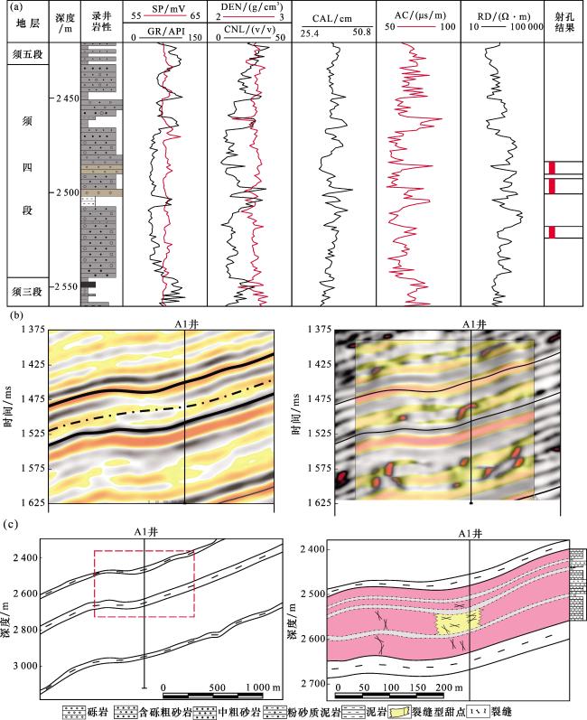
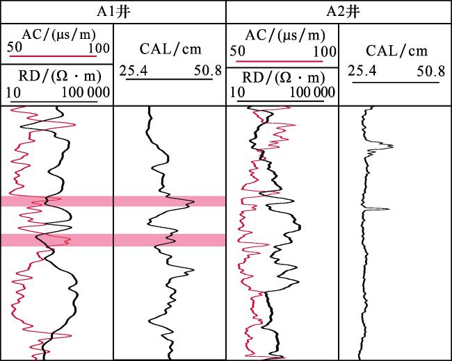
3.2 测井—地震属性裂缝识别
3.3 裂缝储集体平面识别
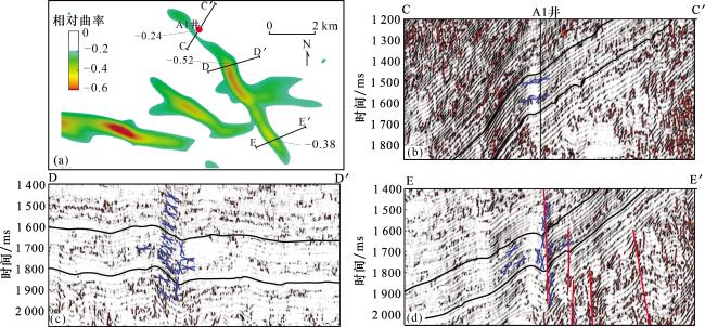
图10 过A1井不同相对曲率与裂缝发育情况(a)A1井附近须四段顶面相对曲率平面分布图;(b)过A1井方差属性地震剖面及裂缝识别; (c)D—D‘测线方差属性地震剖面及裂缝识别;(d)E—E‘测线方差属性地震剖面及裂缝识别 Fig.10 Fracture abundance under the different relative curvature across the Well A1 |


 甘公网安备 62010202000678号