碳酸盐岩沉积演化模式与沉积相分布——以鲁卜哈利盆地东北部上白垩统Mishrif组为例
Sedimentary evolution model and sedimentary facies distribution of carbonate rocks: Case study of Mishrif Formation in northeast Rub Khali Basin
碳酸盐岩沉积演化模式与沉积相分布——以鲁卜哈利盆地东北部上白垩统Mishrif组为例 |
| 卞从胜,李永新,吕明胜,刘刚,段海岗,罗贝维,黄擎宇,张静,杨沛广,张新顺,宋金民,黄理力 |
|
Sedimentary evolution model and sedimentary facies distribution of carbonate rocks: Case study of Mishrif Formation in northeast Rub Khali Basin |
| Congsheng BIAN,Yongxin LI,Mingsheng LÜ,Gang LIU,Haigang DUAN,Beiwei LUO,Qingyu HUANG,Jing ZHANG,Peiguang YANG,Xinshun ZHANG,Jinmin SONG,Lili HUANG |
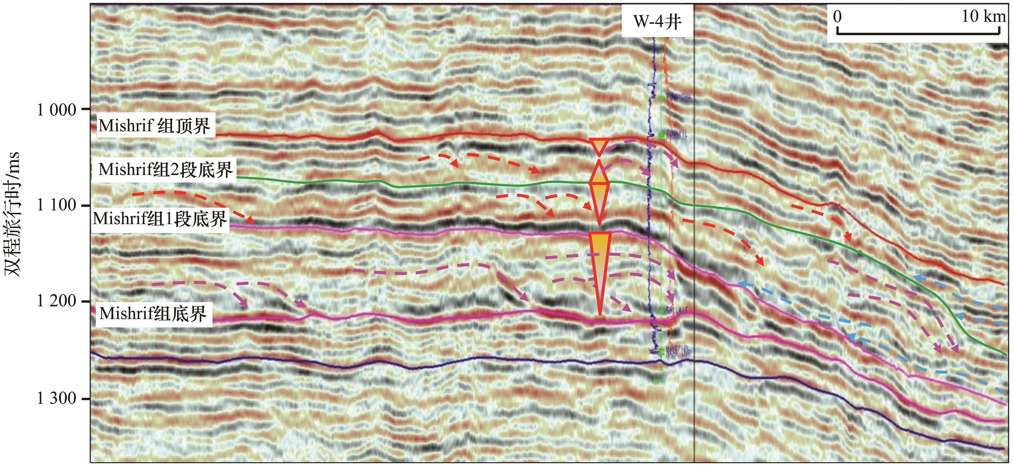
| 图6 研究区南部近东西向Mishrif组地震层序地层格架、边界特征与沉积物叠加样式 |
| Fig.6 Seismic sequence stratigraphic framework, boundary characteristics and sediment overlay pattern of the early east-west Mishrif Formation in the southern part of the study area |
|
|